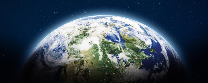
Earth Sciences
Welcome to the University of Regina Department of Earth Sciences!
The University of Regina Department of Earth Sciences (formerly the Department of Geology) offers two undergraduate programs: the B.Sc. in Geology and B.Sc. in Environmental Geoscience. Graduates of these programs are eligible for APEGS (Association of Professional Engineers and Geoscientists of Saskatchewan) membership that is transferable to every other jurisdiction in Canada.
We also have M.Sc. and Ph.D. graduate research programs. Our faculty research areas include traditional "hard rock" and "soft rock" geological studies, mineral and oil-gas resources, and environmental geoscience.
We have an established reputation for training highly "rock-conscious" students, and we are extremely proud of our students' employment record.
We hope you enjoy your visit to our website today, and please reach out if you have questions or suggestions for our site!
Students: resource websites for you!
We have created an undergraduate student homepage (see links at right), that includes a program section to help you ensure you are on track in your program planning. We encourage you to make an appointment with our departmental advisors to help you plan your program (ideally early in your second year) and if at any time you need extra support or you just want to review your progress towards your degree, be sure to reach out to our departmental advisors to check in.
Important note for students: course codes change!
Please be aware that starting Spring/Summer 2025, our courses are now coded Earth Sciences (ESC) in the registration system. All courses formerly coded Geology (GEOL) still have the same course numbers and the new department code (ESC). For example, GEOL 102 is now ESC 102. When students access the registration system to look for courses, they will need to search for Earth Sciences rather than Geology courses. Please contact the Earth Sciences or Science advisors if you need assistance with finding the courses in the registration system.
Contact the Department of Earth Sciences
Explore Earth Sciences


Outreach

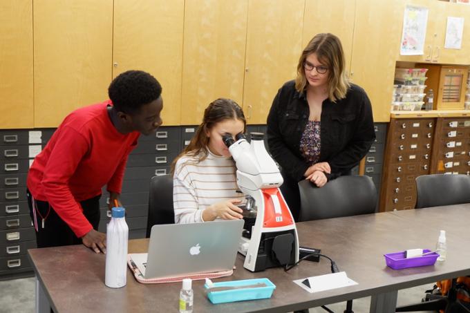
Do you have questions about a rock you have found, or are looking for information on getting a tour or having a geologist present to your group? We offer a number of outreach activities to the general public!

Feature Stories

Retirement - Prof. Hairuo Qing

Prof. Kathryn Bethune wins the J. Willis Ambrose Medal
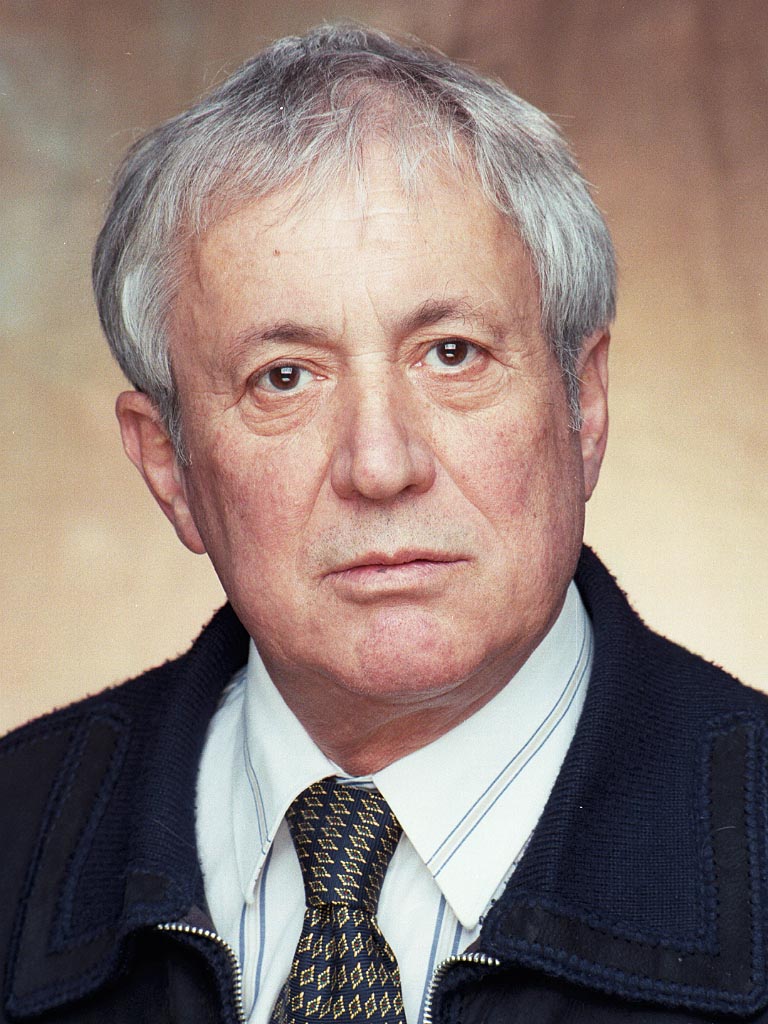
In Memorium - Prof. Emeritus Pier Binda

Welcome Dr Derek Leung
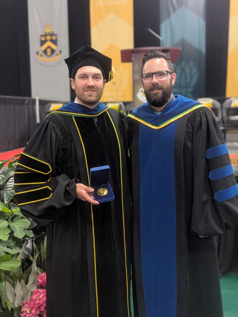
Brendan Bishop (PhD student) awarded Governor General's Gold Medal
Brendan Bishop (PhD student) was awarded the Governor General's Gold Medal at Spring 2025 Convocation. Congratulations Dr Bishop!

Jordan Deane (PhD student) wins NAGT Outstanding TA Award
Goktug Harmanci (MSc student), Nahanni Young (MSc student), and Claire Stephenson (BSc student) win best student posters
Congratulations to graduate students Goktug Harmanci (MSc student) and Nahanni Young (MSc student) on winning first and second prize for graduate posters at the 2024 SGS Open House, and to Claire Stephenson for her first for undergraduate student posters. Well done to our students!
Dr J. Normand receives the 2024 Faculty of Science Excellence in Teaching Award
Kaitlyn Crawford (MSc student) wins NAGT Outstanding TA Award
Prof. Hairuo Qing receives the 2023 Faculty of Science Long-Service Award
Congratulations to Prof. Hairuo Qing who received the 2023 Faculty of Science Long-Service Award. Hairuo's research contributions, teaching, mentorship, and service were particularly noted by Dean Farenick in his statements.
General interest Earth Science courses offered for Fall 2025 and Winter 2026 semesters
In Fall 2025 the only general interest Earth Science course we are offering is ESC 102 (Earth and the Environment). This is a course that qualifies as a lab elective for many science and arts programs at URegina. In Winter 2026 we will offer both ESC 102, ESC 270 (Earth Resources and the Environment), and ESC 460 (Applied Exploration Geophysics). ESC 102 is a prerequisite for ESC 270, and the requirements for ESC 460 are MATH 110, PHYS 112 or PHYS 119 and ESC 201 or permission of the Department Head.